In January 2020, the community of Kangaroo Valley, in New South Wales, was severely affected by the Currowan bushfire, which destroyed about ten percent of homes and caused serious damage to people, infrastructure, the economy, and ecosystems. The research carried out on this case, based on more than seventy interviews and technical assessments of thirty-seven buildings, highlighted how local resilience had already been developing before the event thanks to the work of the Kangaroo Valley Community Bushfire Committee. Since 2018, nine Bushfire-Ready Neighbourhood Groups had been established, with neighborhood coordinators, shared family plans, and simple yet redundant communication systems, such as WhatsApp and UHF/CB radios. This model supported clearer decisions regarding evacuation or staying to defend, reducing the number of undecided residents and leading some to change their minds and evacuate. Another important aspect was the spread of home retrofits, with around 35% of properties undergoing more substantial upgrades. Immediately after the fire, the community set up the Kangaroo Valley Bushfire Recovery Association in just three days, opening a recovery drop-in centre to provide immediate support and raising over one hundred thousand dollars for residents. This space offered both practical assistance and psychological help, proving essential while official services were overwhelmed. In 2023, the experience was consolidated in the new organization Resilient KV, which extended the approach to all hazards, maintaining the neighborhood network and developing a participatory map of resources and vulnerabilities.
Map
Resilient Kangaroo Valley
General Information
Community-led resilience model for improving wildfire preparedness and recovery
Kangaroo Valley, a rural community in New South Wales surrounded by national parks, is highly vulnerable to bushfires due to its isolated geographic location. In January 2020, the Currowan bushfire destroyed about 10% of homes and severely affected people, infrastructure, and ecosystems, highlighting both the limits of official emergency systems and the strength of residents’ self-organization. Even before the event, neighborhood groups and shared family plans had been established, which facilitated response and recovery. From this experience, Resilient Kangaroo Valley was created, now carrying forward a community-led, multi-hazard approach to long-term resilience.
Hazard Type
Geographical Scope - Nuts
Geographical Scope
Population Size
Population Density
Needs Addressed
Kangaroo Valley is an isolated, forested rural area highly exposed to bushfires. During the Currowan bushfire (January 2020), the valley faced widespread destruction, limited escape routes, communications blackouts, and significant uncertainty among residents about whether to stay or evacuate. Official services were overwhelmed and recovery assistance was fragmented. This combination of high hazard, logistical vulnerability, and information gaps prompted the community to create a solution to improve preparedness, coordination, communications, and post-event support.
Elderly: greater mobility limitations and reduced physical endurance during rapid evacuations; possible dependence on medications, electrical devices (e.g., oxygen therapy), and caregivers; higher risk during prolonged blackouts and home isolation.
Children: need age-appropriate communication and procedures; high vulnerability to stress/trauma; require plans coordinated with schools, transport, and family reunification points; need dedicated kits (documents, contacts, comfort items).
People with disabilities: physical/sensory/cognitive barriers to alerts and evacuation; need assistive devices, dedicated transport, and continuity of therapies; individual emergency plans (IEPs) integrated with neighbors and services.
In New South Wales, emergency management is set from the top by the State Emergency Management Committee through the EMPLAN, which clarifies who does what across prevention, preparedness, response, and recovery. On the ground, incidents run under AIIMS the Australian version of the Incident Command System so roles, objectives, and information flow stay consistent even when multiple agencies are involved. For bushfires, the NSW Rural Fire Service is the lead (“combat”) agency and issues public warnings; for storms and floods, that role shifts to the NSW State Emergency Service, with Police, Health, and others supporting as needed. At the local tier, councils convene Local Emergency Management Committees that prepare multi-hazard plans and pre-identify evacuation centres, which can be opened by the Incident Controller and operated by the Department of Communities and Justice. Within this framework, Kangaroo Valley’s neighbourhood groups and, later, Resilient Kangaroo Valley function as a community-led layer that plugs into the official system sharing information, aligning messages, and helping residents prepare, evacuate, and recover.
In New South Wales, preparedness is embedded in the official EMPLAN framework and the AIIMS command system, with the NSW Rural Fire Service (RFS) as the lead agency for bushfires and the NSW State Emergency Service (SES) for storms and floods, in coordination with Police, Health, and local LEMCs. At community scale such as in Kangaroo Valley the neighbourhood network maintains redundant alerts (WhatsApp and UHF/CB radio) to overcome blackouts, updates a pre-season “stay/leave” register, and disseminates simple household plans (roles, reunification points, kits including medications/devices and pets). Vulnerability assessments and property hardening measures (perimeter clearing, pumps/hydrants, water tanks) are carried out, supported by a participatory map of resources and risks kept also in hard copy. Integration with RFS/LEMC ensures clear messaging protocols and procedures for opening centres; throughout the year there are drills and targeted training (schools, older adults, disabilities), plus a buddy system for at-risk residents, orderly management of spontaneous volunteers, and pre-set messages to counter rumours and misinformation.
In the area, volunteer brigades of the NSW Rural Fire Service operate from a local station (vehicles, workshop/garage, and a coordination point), while the Council has pre-identified buildings that can serve as evacuation/assistance centres; when needed, these are activated by the Incident Controller and operated by the Department of Communities and Justice. At community level, UHF/CB radio networks and WhatsApp groups provide redundancy when mobile networks fail; nevertheless, there are persistent mobile “black spots” and frequent power outages during severe events. Firefighting water supply relies on a mix of hydrants where available and on local reserves (household tanks, standpipes, dams/ponds), mapped as “static water sources” and shown on community maps together with escape routes and safe areas. Access roads are few and include bridges/single-lane sections that are critical for evacuation flows and emergency convoys. Many homes have undertaken property-hardening measures (perimeter clearing, pumps connected to tanks, fittings for RFS appliances), and the community has already demonstrated the ability to quickly set up a post-event recovery centre.
- Co-creation of plans: household and neighborhood plans, evacuation procedures, messaging protocols.
- Operational alignment: integration with RFS/LEMC (AIIMS), clear roles and shared channels.
- Participatory mapping: resources, risks, escape routes, “static water” sources.
- Protection of vulnerable groups: buddy system, targeted check-ins, individual plans.
- Capacity building: drills, training for schools/older adults/disabilities, coordinator training.
- Volunteer management: single intake point, safe tasking, registration and PPE.
- Timely decisions: “stay/leave” register, reduced indecision, redundant early warning.
- Post-event recovery: activation/operation of the recovery centre, access to funds and services, psychosocial support.
- Neighbourhood Groups & coordinators (network, 9 groups, coordinators/deputies).
- WhatsApp communications and UHF/CB radio for redundancy.
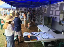
- Public/participatory meetings (Public Bushfire Awareness Community Meeting 2018; pre-fire neighbourhood meetings).
- Household bushfire plans (support, shared examples, strong encouragement).
- “Stay/leave” intention register shared with the KVVRFB brigade to prioritise checks.
- Recovery drop-in centre / KVBRA (activated in 3 days; practical and psychosocial services; fundraising).
- Participatory mapping / Preparedness Map (hydrants, “static water,” assets, risks).
- Liaison with RFS/Council/LEMC and consolidation into Resilient KV (2023)
In designing and implementing the solution, the Neighbourhood Groups were created through a bottom-up participatory process that defined boundaries and coordinators/deputies for nine groups; members produced and shared household plans, documents, and maps, and activated WhatsApp channels and UHF/CB radio for operational management. In the week before the fire arrived, the groups compiled a database of “stay or leave” intentions and provided it to the local brigade (KVVRFB), enabling responders to prioritise checks on those intending to stay—an action rated as extremely important by both the community and services. During recovery, the community established a recovery drop-in centre within three days (later formalised as KVBRA), which helped residents find accommodation, contact insurers and banks, and access funds, and it was widely praised for its practical and psychosocial impact. Subsequently, the experience was consolidated with the creation of Resilient KV (November 2023), which continues coordinating the Neighbourhood Groups Network and develops the Preparedness Map with community layers (hydrants, static water sources, assets, risks), strengthening two-way channels with KVVRFB.
After the Currowan fire, the community consolidated its initiatives into an incorporated entity, Resilient KV (November 2023), with a mandate covering all hazards and all phases of the emergency cycle; this enables access to funding and insurance coverage, ensuring continuity and long-term capacity. In parallel, a pre-configured recovery drop-in centre is being planned for future events, including advance agreements on venues, liaison with the council, and volunteer training (administration, IT, data management) with trauma-informed practices to protect residents and volunteer wellbeing. The Neighbourhood Groups Network continues and is now more closely connected with the KVVRFB through a coordinators’ WhatsApp group, strengthening two-way information flow and decision readiness. The community is also developing an online Preparedness Map with local layers (hydrants, static water sources, assets, risks), codifying territorial knowledge to support decision-making and operational priorities in future seasons.
Vulnerable Groups
Governance
Emergency Preparedness
Infrastructure Readiness
Engagement Level
Empowerment Level
Implementation
- Bottom-up network of nine Neighbourhood Groups: boundaries and coordinators/deputies defined through a participatory process; documents and maps produced and shared across groups.
- Redundant communications: one WhatsApp group per neighbourhood and UHF/CB radios to bridge mobile network blackouts and black spots.
- Pre-event “stay-or-leave” register: collected the week before fire impact and provided to the KVVRFB to prioritise property checks; assessed as extremely important by community and services.
- Recovery drop-in centre in three days: a one-stop post-disaster hub offering practical and psychosocial support and local fundraising; widely praised as a community support model.
- Incorporation as Resilient KV (November 2023): expansion to all hazards and all phases of emergency management; improved access to funding and insurance; continuity of the neighbourhood network.
- Online participatory Preparedness Map: shared local layers (hydrants, static water sources, assets, risks) to guide decisions and operational priorities in subsequent seasons.
- Structured linkage with the local brigade: KVVRFB officers included in the coordinators’ WhatsApp group for tighter two-way information flow.
English
- Resilient Kangaroo Valley (Resilient KV) - current entity that manages and coordinates the solution (neighbourhood network, preparedness map, liaison).
- Kangaroo Valley Bushfire Recovery Association (KVBRA) - managed the recovery drop-in centre in the post-fire phase.
- Kangaroo Valley Community Bushfire Committee (KVCBC) - initiated the Neighbourhood Groups network in the early phase.
- KVCBC (pre-event): designed and launched from the bottom up the network of nine Neighbourhood Groups (boundaries, coordinators/deputies), promoting household plans, shared documentation, and redundant communications (WhatsApp + UHF/CB).
- Emergency management (during): one week before the fire’s arrival, it collected the “stay/leave” intentions register and shared it with the local brigade (KVVRFB) to prioritise property checks an operation assessed as crucial by the community and services.
- KVBRA (immediate post-event): established a recovery drop-in centre in three days as a one-stop hub for accommodation, insurers/banks, access to funds, and psychosocial support; its effectiveness is widely acknowledged in the case study.
- Resilient KV (consolidation): since November 2023 it has continuously coordinated the network, maintained a direct channel with KVVRFB (coordinators’ group), and developed an online Preparedness Map with local layers (hydrants, static water sources, assets, risks) to guide decisions and operational priorities in subsequent seasons.
- Resilient Kangaroo Valley (Resilient KV) – ongoing coordination, development of the Preparedness Map, liaison with other actors.
- Neighbourhood Groups (nine groups with coordinators/deputies) – neighbourhood organisation, household plans, communications, and “stay/leave” data collection.
- Kangaroo Valley Volunteer Rural Fire Brigade (KVVRFB) – uses neighbourhood data to prioritise checks; information exchange with coordinators.
- Kangaroo Valley Bushfire Recovery Association (KVBRA) – management of the post-fire recovery drop-in centre.
- Council/Local Emergency Management Committee (LEMC) - local reference for plans and evacuation/assistance centres.
- Households/residents – implementation of plans, property retrofits, participation in mapping and preparedness activities.
- Initial community activation: public assembly; creation of the Kangaroo Valley Community Bushfire Committee; definition of nine Neighbourhood Groups with boundaries, coordinators, and deputies.
- Set-up of channels and materials: launch neighbourhood WhatsApp groups; purchase/use of UHF/CB radios; produce and share documents, maps, and household plan templates.
- Neighbourhood operational organisation: phone/contact trees; simple roles and procedures for alerts, check-ins, and mutual support between families.
- Pre-season actions: collect and update the “stay/leave” register; participatory mapping of resources/risks (hydrants, static water sources, escape routes, safe areas); property hardening measures.
- During the event: coordinated use of WhatsApp and UHF/CB; share the register with KVVRFB to prioritise checks on those intending to stay; support evacuation decisions.
- Immediate recovery (within three days): open a recovery drop-in centre (one-stop hub for accommodation, insurers/banks, access to funds, psychosocial support).
- Institutional transition: formalise the centre and activities into the Kangaroo Valley Bushfire Recovery Association (KVBRA).
- Long-term consolidation: incorporate Resilient Kangaroo Valley (Resilient KV, 11/2023) with an all-hazards, all-phases mandate; maintain the neighbourhood network and direct channel with KVVRFB.
- Permanent tools: develop the online Preparedness Map with shared local layers; periodically update plans, maps, and registers.
- Capacity and sustainability: plan a pre-configured recovery centre for future events; train volunteers (administration/IT/data) with trauma-informed practices; secure agreements and coverage to ensure continuity.
Unclear information
- 2018: public assembly → KVCBC is formed and the community model is set up.
- 2019: nine Neighbourhood Groups are organised with boundaries and coordinators/deputies; WhatsApp groups activated; UHF/CB radios adopted where coverage is poor.
- Late 2019–early 2020: widespread preparations/retrofits (≈35%).
- Week before impact: “stay/leave” register collected and delivered to KVVRFB to prioritise checks.
- 4 January 2020: the fire hits the valley; ~50 houses destroyed (~10%).
- Within 3 days: recovery drop-in centre opens → later KVBRA; supported by local fundraising.
- 2020–2023: continued work between recovery and new preparedness; ties with services strengthened.
- November 2023: Resilient KV is incorporated with an all-hazards mandate and access to funds/insurance.
- From 2023: planning of a pre-configured recovery centre and development of the online Preparedness Map (hydrants, static water, assets, risks).
- Ongoing: closer linkage with KVVRFB (officers in the coordinators’ WhatsApp group).
Experience of the Implementing Organisation in DRM
Target Audience
Resources Required
Timeframe & Phases
Participation Results
- Geographic isolation and limited escape routes → created a network of nine Neighbourhood Groups with defined boundaries and coordinators/deputies to organise local support and flows.
- Power outages and mobile network black spots → established redundant communications: neighbourhood WhatsApp groups plus UHF/CB radios purchased by coordinators.
- Uncertainty about “stay or evacuate” decisions → compiled a pre-event “stay/leave” register the week before impact and shared it with KVVRFB to target checks.
- Overstretched official services and fragmented post-event assistance → opened a recovery drop-in centre within three days (later KVBRA) as a one-stop hub for accommodation, insurers/banks, access to funds, and psychosocial support.
- Need to prioritise water resources and operational tasks on the ground → developed a participatory Preparedness Map with local layers (hydrants, static water sources, assets, risks) to support decisions.
- Risk of effort dispersion and need for continuity → incorporated Resilient KV (Nov 2023) with an all-hazards mandate and access to funding/insurance; maintained a direct channel with KVVRFB.
- Operational coordination with emergency services → set up a structured linkage (KVVRFB officers in the coordinators’ WhatsApp group) for faster two-way information exchange.
- Redundant communications: neighbourhood WhatsApp groups plus UHF/CB radios.
- Pre-event “stay/leave” register shared with KVVRFB to prioritise checks and support evacuations.
- Participatory Preparedness Map with local layers (hydrants, static water sources, escape routes, safe areas, assets/risks), also kept in hard copy.
- Property hardening/retrofits: perimeter clearing, pumps/hydrants connected to tanks, other defensible-space measures.
- Response/recovery centres: rapid activation of a recovery drop-in centre; planning of a pre-configured centre for future events.
- Integration with the official system: direct channels and shared protocols with KVVRFB and Council/LEMC.
- Safeguarding volunteers and the community: training for the centre (administration/IT/data) with trauma-informed practices.
- Continuity and sustainability: incorporation of Resilient KV with an all-hazards mandate to secure funding/insurance and maintain tools and skills over time.
Risk & Mitigation Plan
Scalability and Sustainability
Governance: the experience has been institutionalised by incorporating Resilient Kangaroo Valley (November 2023), with an all-hazards mandate across all phases. The entity maintains the Neighbourhood Groups Network, a direct channel with the local brigade (coordinators’ WhatsApp group), and liaison with the Council/LEMC, preserving organisational memory and decision continuity.
Financial: incorporation enables access to funding and insurance coverage, complemented when needed by local fundraising already tested (community donations, events). This mix reduces dependence on a single source and supports recurring costs (tools, training, data management, logistics).
Operational: permanent, updatable tools are in place: an online Preparedness Map (with hard copies) guiding priorities and decisions; standardised plans, registers, and protocols shared across groups; a pre-configured recovery centre with advance agreements on venues and activation procedures. Volunteer training (administration/IT/data management) includes trauma-informed practices to protect residents and responders. Redundant communications (WhatsApp + UHF/CB) ensure operations during blackouts or mobile “black spots.” Periodic updates and debriefings sustain continuous improvement.
Although not a one-size-fits-all model, elements of the approach can be adopted and adapted in other communities with different contexts, resources, and capacities.
Participatory mapping (a Preparedness Map with local layers) builds on documented practices and provides a replicable method to integrate local knowledge with operational decisions.
The organisational evolution into Resilient KV with an all-hazards, all-phases mandate makes the framework transferable beyond bushfire risk, supporting multi-hazard applications in similar settings.
- Combined, redundant use of digital and analog channels: neighbourhood WhatsApp groups plus UHF/CB radios to overcome blackouts and mobile “black spots.”
- Online Preparedness Map with local layers (hydrants, static water/tanks, assets, risks), also maintained in hard copy.
- Pre-event “stay or leave” database/register and contact trees for alerts and operational prioritisation.
- Technical equipment for property hardening (pumps connected to tanks, hydrants/static water points).
Information not available
Information not available
- Neighborhood planning and the pre-event “stay/leave” register made decisions faster and clearer (many evacuated early).
- Redundant communications (WhatsApp + UHF/CB) were crucial during power outages and mobile “black spots.”
- The recovery drop-in centre opened within three days was decisive for practical and psychosocial support.
- Property retrofits and preparations (≈35% more extensive works) increased material resilience.
- Formalising into Resilient KV and developing the Preparedness Map ensured continuity, a multi-hazard approach, and better decision-making capacity.